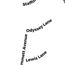
33 EMMETT AVE
Owner Information
OSMENI MARIUS ETUX
33 EMMETT AVE
DEDHAM, MA 02026


Property Details
33 EMMETT AVE is classified as a SFR WATER (Conventional).
The primary structure on this property was built in 1890. There are 2,155ft2 of built area within this property. There is 1,008ft2 of residential/living space within this property. This property is listed as having 6 rooms.
33 EMMETT AVE is valued at $379,100. The land is valued at $249,900 and the structures are valued at $127,300. There is an additional valuation of $1,900 on this property.
This property is in Zone B. Confirm with local Zoning Board authorities to ensure there are no overlays or other easements on this property.
The most recent deed for 33 EMMETT AVE is recorded at the local registrar in Book 35833, Page 445. 33 EMMETT AVE was last sold on Friday, March 2, 2018 for $289,700.
Assessment data from fiscal year 2020.
Flood Data
According to the FEMA National Flood Hazard Layer, this property does not appear to be in a flood zone. It may also be in an area not yet reviewed. Nonetheless, confirm this information prior to taking any action.
To view the flood hazards around this property, create a FEMA "Firmette" Map of the area around 33 EMMETT AVE.
Broadband Internet Providers
| Provider | Type | Bandwidth (mbps) | |
|---|---|---|---|
| Viasat Inc | Satellite | 100 | 3 |
| RCN | Cable | 500 | 20 |
| Comcast | Cable | 1000 | 35 |
| Verizon New England Inc. | Fiber | 940 | 880 |
| VSAT Systems, LLC. | Satellite | 2 | 1 |
| HughesNet | Satellite | 25 | 3 |
| GCI Communication Corp. | Satellite | 0 | 0 |
| Verizon New England Inc. | DSL | 1 | 0 |
Broadband service provider data from December 2020.
Adjacent Properties
- 15 SAWMILL LN
Vacant, Housing Authority owned by DEDHAM HOUSING AUTHORITY - 29 EMMETT AVE 1
Condo NL MDL-05 owned by AUDUONG AARON ETAL - 31 EMMETT AVE 2
Condo NL MDL-05 owned by FITZPATRICK DONNA - 29-31 EMMETT AVE
Other, Open Space owned by BAYSTATE PROPERTIES RE LLC - 25 EMMETT AVE
SFR WATER owned by KHAN MOHHAMMED JAVID ETUX - 65 EMMETT AVE
SFR WATER owned by WALD REID NOMINEE TRUST - 39 EMMETT AVE
Single Family Residential owned by HILL EVAN ETUX